
Surname density map
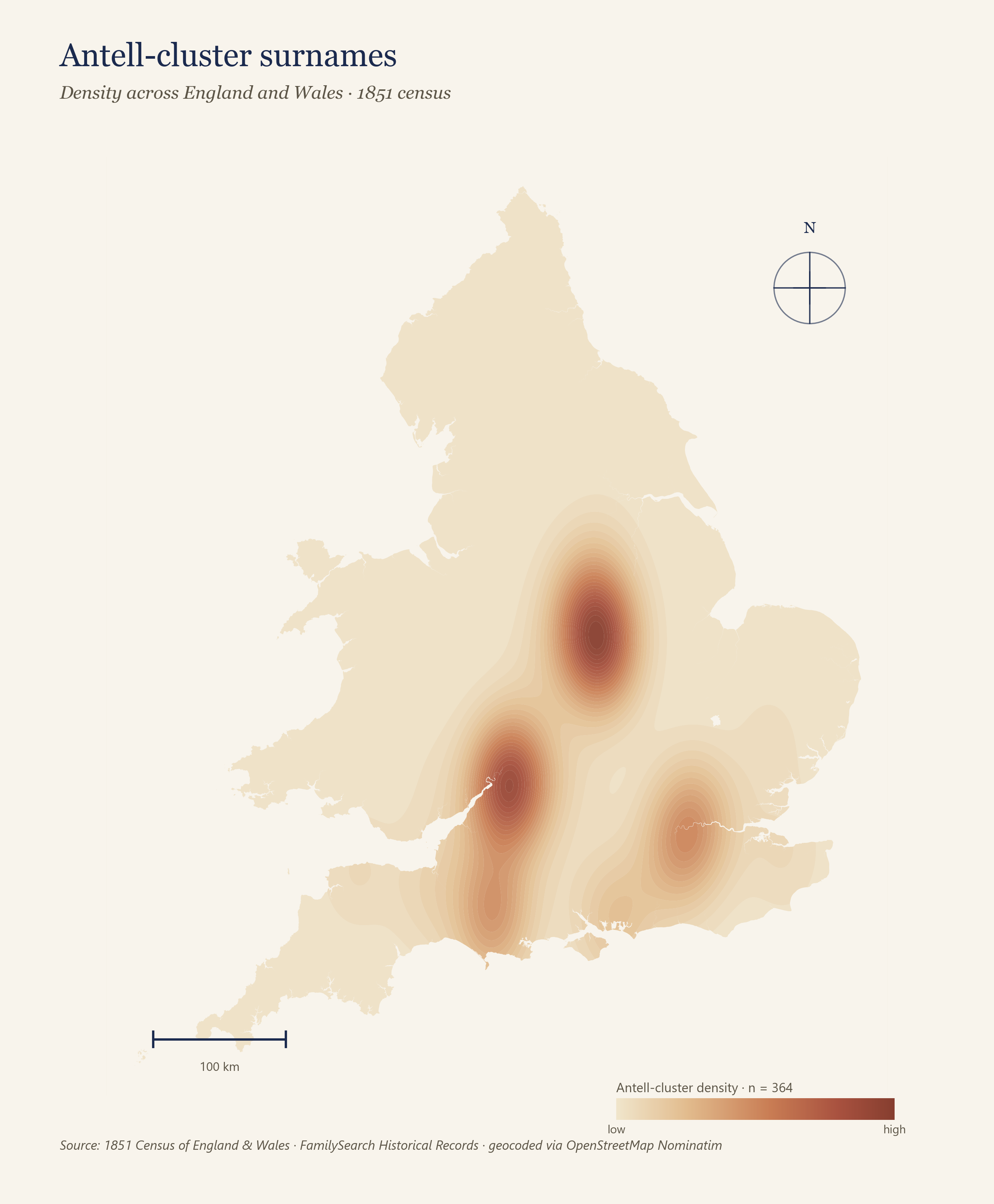
Kernel-density heatmap shows concentrations of surnames. For less common surnames, geographic proximity is often enough to suggest a familial relationship, even when the paper trail is inconclusive.
Geographic research for family historians
Rootscape is a research platform that turns historical records into surname heatmaps, enabling cluster analysis and an intuitive understanding of migration patterns. These geographic methods can solve brick walls that text-only search cannot.
Rootscape delivers three core pieces of analysis for every surname.
Kernel-density heatmap shows concentrations of surnames. For less common surnames, geographic proximity is often enough to suggest a familial relationship, even when the paper trail is inconclusive.
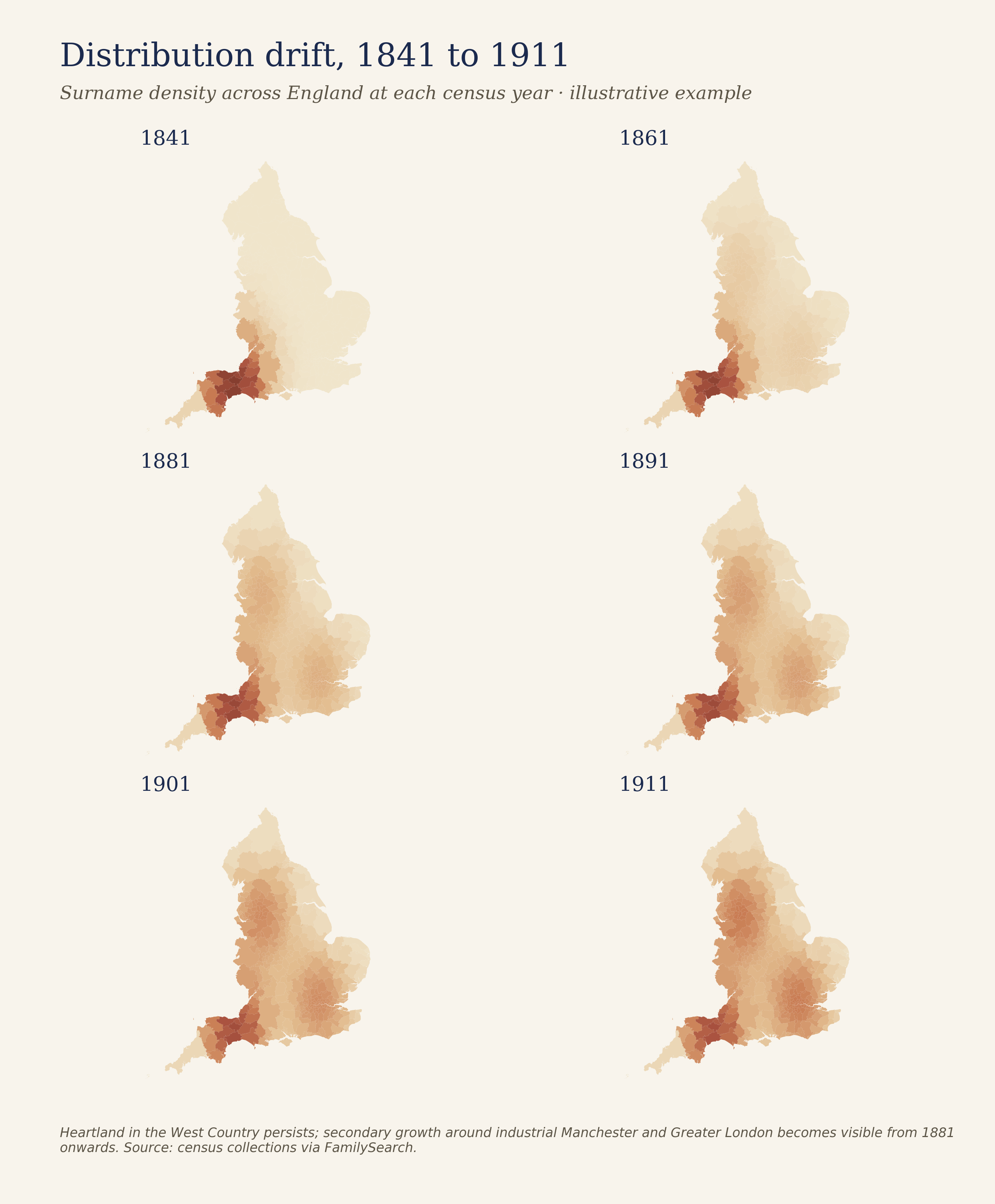
Time-series mapping how a surname's footprint shifts over time. Migration flows out of the heartland become visible at a glance.
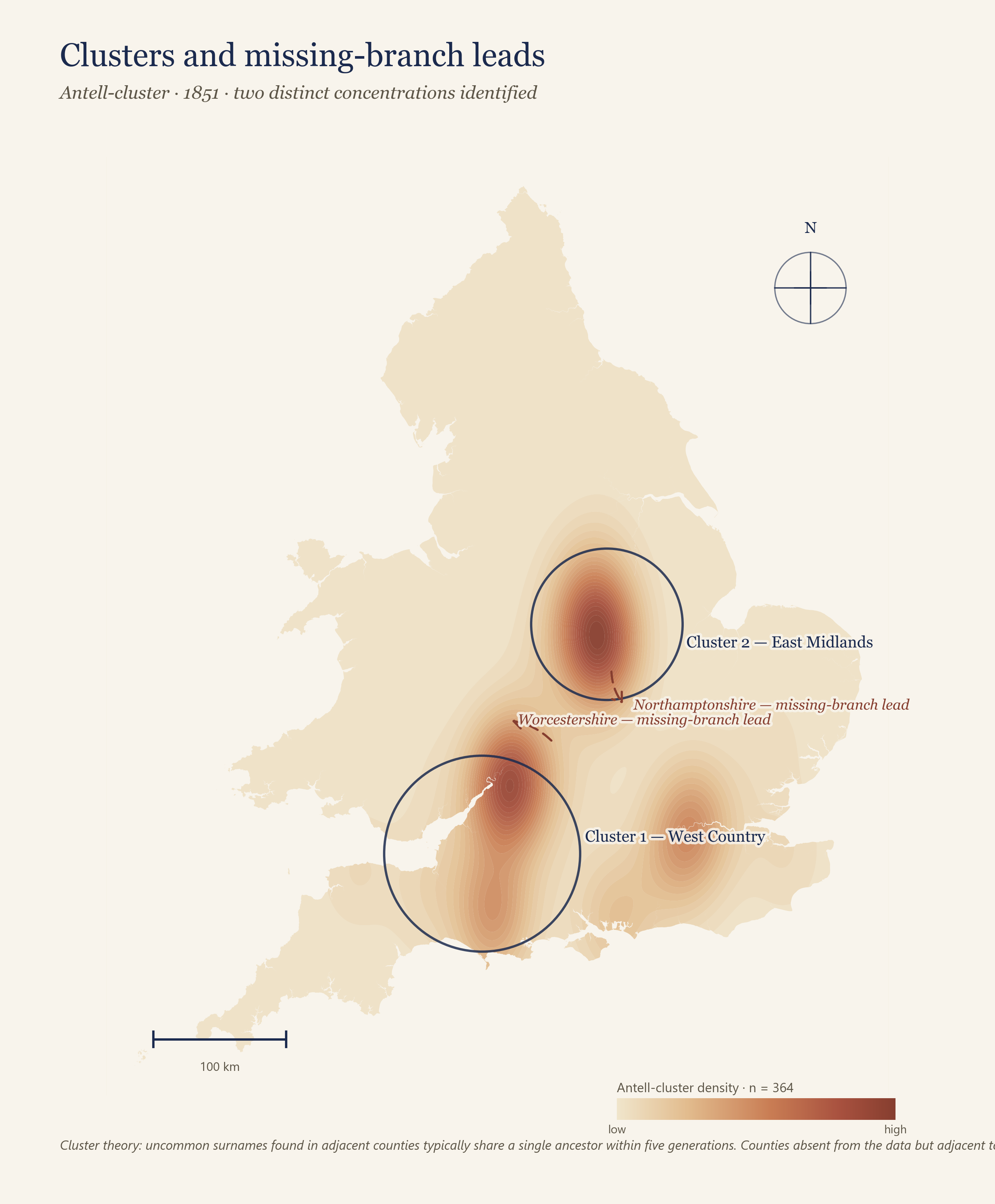
Statistical clustering identifies geographic kinship pockets, and flags adjacent counties where the absence of the surname is itself a research clue.
Each Rootscape study is presented as a structured research pack – designed not just to be read and enjoyed, but to unlock specific next steps in your genealogy research.
Print-quality density maps, time-series small multiples, and cluster overlays. Delivered as PDF and high-resolution PNG, suitable for journal publication.
A structured list of insights that can be added to persons in your family tree (including FamilySearch trees).
A written interpretation of what the geography tells you: the (multiple) heartlands, the outliers, the migration story, and the research findings the maps imply.
Why geography
Most family-history platforms organise records as text-based data. You run a search, and the results appear as a long list of names, places and dates. This is central to documentary research. But researchers building a family tree are faced with brick walls when one record doesn't map neatly onto another; meanwhile, surname researchers (e.g. those running One Name Studies) face a difficult synthesis and analysis task to get a holistic sense of the name they are studying.
Graphical methods – including mapping – can help overcome these issues.
Cluster theory holds that uncommon surnames found in the same small area almost always share a single common ancestor within the genealogical timeframe. When a name appears to vanish, sometimes it has gone extinct, but oftentimes it has migrated. The map shows the route.
Rootscape exists because these geographic methods are under-resourced and underused in mainstream genealogy. We bring them to bear for all family historians.
Rootscape is in a closed beta with a small group of avid testers. Leave your details and we will be in touch with study slots, pricing, and a sample report.